Mahawu Volcano
Mahawu Volcano
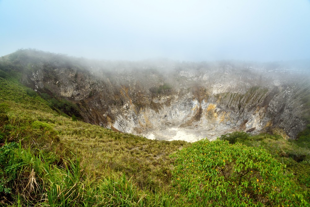
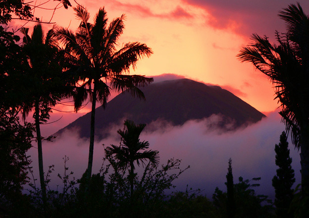
East of Tomohon, Mahawu (1,324 m) offers a short ascent to an active crater, a sulfuric lake and views over the volcanoes of northern Sulawesi.
Mahawu volcano rises east of Tomohon, in North Sulawesi province, some thirty kilometers from Manado. With its modest altitude of 1,324 m, an active crater and short trails accessible to beginner hikers, it ranks among Indonesia's most approachable volcanic climbs. Its local nickname, Roemengas mountain, and its Minahasan name — Mahawu meaning "ash" — recall an eruptive past that continues to shape the landscape.
Why visit Mahawu volcano
Mahawu offers a rare balance between geological interest and accessibility. A concrete road leads to the foot of the crater, and a walk of about one hour is enough to reach its rim. The summit overlooks Manado Bay, nearby islands, Lokon-Empung, Soputan and Mount Klabat (2,000 m), the highest peak in northern Sulawesi.
The contrast with other Indonesian volcanoes is striking: here, the slopes are verdant, cultivated in vegetable gardens by local residents, and bordered by a small protected forest. Around twenty bird species have been recorded, including the Manguni and Celepuk, two nocturnal raptors.
Eruptive history
Mahawu is part of a series of young volcanoes aligned along the margin of the Tondano caldera. Although classified as inactive by Indonesian authorities, it continues to emit sulfuric gas.
An eruption in 1789 shaped the current summit crater and gave rise to a sulfur pond. In 1994, a brief explosive phase produced fumaroles, hot mud pools and small geysers along the crater lake. Since then, activity has remained subdued, but ancient lava flows, bombs, lapilli and ash remain visible along the trails.
What you see on site
The crater and its lake
The crater measures approximately 180 m wide by 140 m deep. At the bottom, a crater lake roughly ten meters deep displays elevated temperatures, estimated around 65 °C. A platform built at the rim allows safe observation. The trail skirting the crater varies in terrain and offers different viewpoints on the two pyroclastic cones visible on the north flank.
The summit panorama
On clear days, the view encompasses Manado's coastline, offshore islands and the array of nearby volcanoes. It is one of the few summits in the region where one grasps the volcanic geography of northern Sulawesi at a single glance.
Wildlife and cultivated landscapes
The lower slopes are occupied by vegetable gardens where local farmers grow vegetables and market crops. Bird watching is particularly rewarding at daybreak; nocturnal species such as Manguni and Celepuk manifest themselves instead at dusk.
When to go
The dry season, typically from May to October, offers the best visibility conditions from the summit. Early morning, ideally before 9 a.m., remains the most favorable window: the air is clear, temperatures cool and bird activity at its peak. In the wet season, clouds often blanket the crater by mid-morning.
How to get there
From Manado, allow approximately 30 km and just over an hour's drive. The main route follows the Raya Manado-Tomohon road to the North Tomohon sub-district, then turns toward the village of Kakaskasen Satu, the ascent's starting point.
An interesting alternative departs Tomohon toward Rurukan: a trail crosses vegetable gardens, then a forest and a shaded cone, before descending toward 1,200 m altitude. This option, longer, demands more hiking but traverses varied landscapes.
Practical information
- Duration of visit: allow 1 to 2 hours round trip from the parking area.
- Level: easy, accessible to beginners; closed-toe shoes recommended.
- Guide: not mandatory for the main trail, but advised for the Rurukan alternative or in uncertain weather.
- Fee: moderate entry fee collected locally.
- To bring: water, windbreaker, sun protection; sulfur odors can be pronounced at the crater rim.
Nearby attractions
- Doa Hill — Christian viewpoint overlooking Tomohon.
- Rurukan Peak — nearby summit with agricultural trails.
- Tetetana Peak — viewpoint over the valley.
- Lokon-Empung Volcano — immediate neighbor, more demanding to climb.
To extend your discovery of the archipelago, other sites are worth exploring, such as the Sipiso-Piso waterfall in Sumatra, or Komodo Island and Rinca Island in the Lesser Sunda Islands.
Frequently asked questions
Frequently asked questions
Preparing your journey
Mahawu naturally fits into an itinerary around Tomohon and Manado, complementing Bunaken dives or traditional Minahasan markets. To build a complete route through the archipelago, consult our selection of Indonesia travel packages.
Nearby
Interested in this visit?
We can include it in your personalised itinerary.