The Mahakam River
The Mahakam River
Indonesia's largest river located entirely within a single province, the Mahakam connects Samarinda to Dayak villages in central Borneo through lakes and forests.
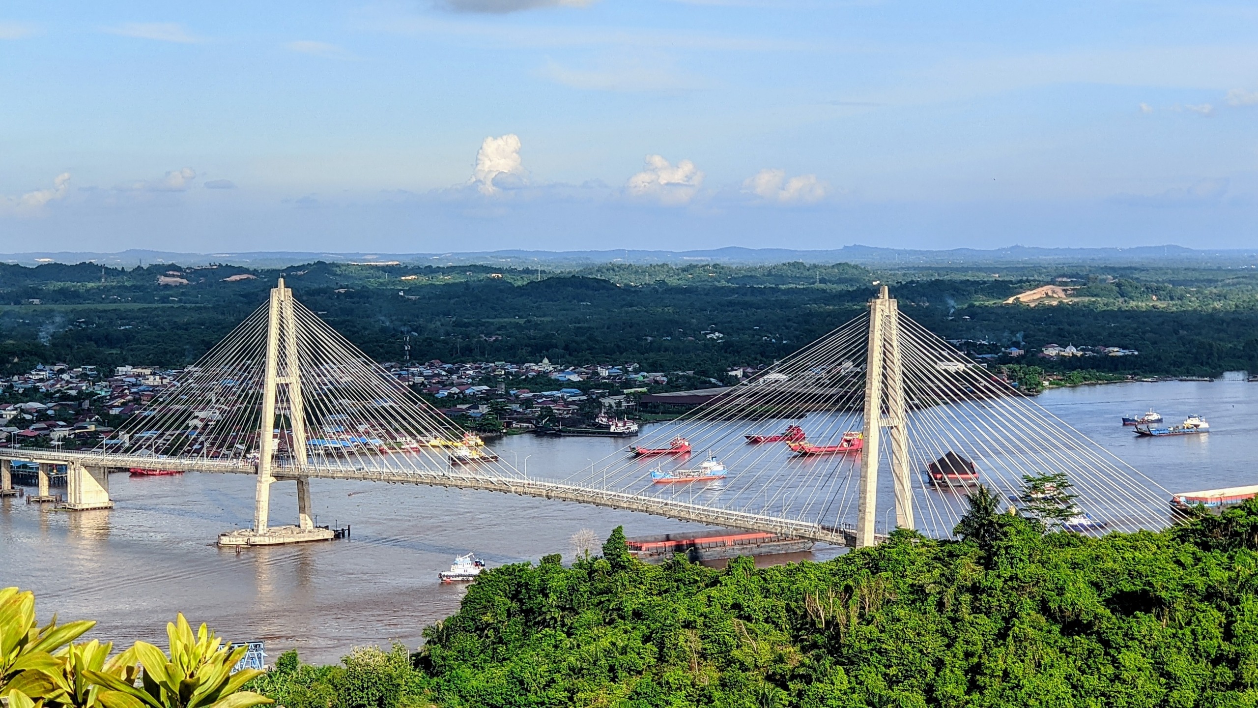
The Mahakam River traverses East Kalimantan province for 980 km, of which 523 km are navigable, from the central highlands of Borneo to the Makassar Strait near Samarinda. It is Indonesia's largest river situated entirely within a single province. Navigating its waters grants access to a series of lakes, tropical forests inhabited by orangutans and Irrawaddy freshwater dolphins, and several Dayak villages.
Why visit the Mahakam River
The Mahakam combines several interests rarely found along a single waterway. Its basin is home to approximately 76 lakes, lowland and mangrove forests, and wildlife endemic to Borneo. The river still serves as the main circulation route between Samarinda and the interior, making it possible to travel upriver by public ferry or furnished riverboat to reach Dayak communities otherwise difficult to access by road.
Travelers come here for three main reasons: observing wildlife (proboscis monkeys, Pesut dolphins, water birds), meeting Dayak villages of the middle and upper Mahakam, and crossing the central lake ecosystems around Jempang, Semayang and Melintang.
Origin of the name and place in Dayak culture
According to an interpretation reported locally, Mahakam would mean "the place where spirits dwell" in Dayak culture. This reading, which should be taken with the caution due to any cultural translation, reflects the spiritual significance of the river for indigenous communities in the basin. The Dayak, comprising several sub-groups (Bahau, Benuaq, Kenyah, Tunjung), developed a way of life centered around the river: communal longhouses built near the banks, family riverboats, ceremonial dances and traditional ornaments such as the elongated earlobes worn by elders.
What to see along the river
The central lakes
The Mahakam basin contains approximately 76 lakes, nearly 30 of which are in the central zone. The three largest are Jempang (15,000 ha), Semayang (13,000 ha) and Melintang (11,000 ha). Water levels vary considerably: 0.5 to 1 m in the dry season, up to 7 m during the rainy season. These lakes and their wetlands serve as a reservoir and sediment trap. Fishing is the main economic activity, with annual fish productivity of 25,000 to 35,000 tonnes measured since 1970.
Wildlife
The forests of the basin are home to orangutans, proboscis monkeys, false gharials (a narrow-snouted crocodilian), clouded leopards, monitor lizards, otters and snakes. In the lower reaches of the river lives the Irrawaddy freshwater dolphin, known locally as Pesut, whose population is now greatly reduced. In terms of birdlife, riverboat excursions allow observation of Brahmin kites, kingfishers, herons and egrets.
Dayak villages
Moving upriver from Samarinda, villages follow one another: Tenggarong (former capital of the Kutai sultanate), Muara Muntai, Tanjung Isuy on Lake Jempang, then further upstream Long Bagun and the Long Apari region, where the river originates in the Kutai Barat regency. Each stage corresponds to half a day to a full day of navigation.
When to go
The region experiences an equatorial rainforest climate, with average annual rainfall of 3,163 mm and average runoff of 1,911 mm. Minimum temperatures do not fall below 18 °C.
- Dry season (May to September approximately): low water levels (0.5 to 1 m on the lakes), navigation sometimes difficult on small tributaries but better wildlife visibility on the banks.
- Rainy season (October to April approximately): water levels reaching up to 7 m, easier navigation across the entire network, but frequent showers and muddy riverside paths.
The transition months (May-June and September) often offer the best compromise.
How to get there
The simplest access is through Balikpapan, the main international airport of East Kalimantan, then traveling north to Samarinda, the usual starting point for river excursions.
- By plane: domestic flights to Samarinda airport (APT Pranoto) from Balikpapan or Jakarta.
- By bus or car: from Balikpapan, approximately 170 km heading north, plan for several hours of driving depending on conditions.
- By river: from Samarinda or Loa Janan, boarding on public ferry, traditional riverboat (kapal) or motorized canoe (ces) depending on desired duration and comfort level.
Practical information
- Recommended duration: an excursion to the central lakes requires 2 to 4 days; traveling upstream to the upper Mahakam (Long Bagun and beyond) requires one to two weeks.
- Accommodation: furnished riverboats with cabins, simple losmen in villages, sometimes staying with locals in longhouses.
- What to bring: waterproof bag for equipment and papers, headlamp, mosquito repellent, lightweight quick-drying clothing, a warm layer for nights on the riverboat.
- Health: plan for antimalarial protection as advised by medical professionals, and basic treatment for digestive troubles.
To see in the region
Before or after the river, several sites allow you to extend your stay or vary the scenery:
- The center of Samarinda with the Islamic Center and riverside parks, the boarding point and logistics hub for the Mahakam.
- The Pampang cultural park, about thirty kilometers from Samarinda, which showcases Dayak Kenyah dances and crafts.
- To extend your Indonesia journey, very different destinations such as the Sipiso-Piso waterfall in Sumatra, Komodo Island and Rinca Island in the Lesser Sunda Islands, or the Bali Botanical Garden.
Frequently asked questions
Frequently asked questions
Plan 2 to 4 days for a circuit of the central lakes (Jempang, Semayang, Melintang) from Samarinda. To reach the upper Mahakam and the most remote Dayak villages, allow 8 to 14 days.
Yes, but sightings are never guaranteed: the population of Irrawaddy dolphins in the lower Mahakam is very small. The most favorable areas are around Muara Pahu and Muara Kaman.
The transition months between dry and rainy seasons (May-June, September) offer a good balance between easy navigation and climatic comfort. The dry season is still possible but limits access to certain tributaries.
An English-speaking guide is very useful beyond Samarinda: public river transport exists but organization, communication and access to Dayak villages are much facilitated by a local guide.
Yes, navigation is a daily practice for inhabitants. Main precautions concern health (mosquitoes, water, sun) and weather: avoid departing during prolonged heavy rain which can make the current difficult.
Planning your trip
The Mahakam naturally integrates into an itinerary combining Borneo and another Indonesian island. To build a custom route including the river and Dayak villages, consult our Indonesia travel suggestions.
Interested in this visit?
We can include it in your personalised itinerary.