Atauro Island
Atauro Island
Located 25 km north of Dili, Atauro brings together some of the world's richest coral reefs, Mount Manucoco at 999 m, and traditional East Timorese villages.
A mountainous island situated approximately 25 km north of Dili, the capital of East Timor, Atauro is a volcanic territory boasting exceptional coral reefs. Long isolated, it preserves today a traditional village fabric, marine biodiversity documented as among the densest on the planet, and a steep terrain peaking at nearly 1,000 metres. Important clarification: Atauro belongs to East Timor (not Indonésie), even though the neighbouring island of Alor to the west is part of the Indonesian archipelago.
Why visit Atauro Island
Atauro combines several rare assets within the same area. Its waters harbour marine biodiversity of global reference: a 2016 study by Conservation International recorded 315 reef fish species on a single site, a record. The island is also classified as an IBA (Important Bird Area) by BirdLife International, making it a stop for birdwatching.
Culturally, the island presents a unique feature: its northern part is home to a Protestant population, a rare occurrence in predominantly Catholic East Timor, a legacy of Dutch Calvinist missionaries from Alor. Four dialects of Wetarese (Rahesuk, Resuk, Raklungu, Dadu'a) are still spoken here. Finally, tourist attendance remains moderate and infrastructure prioritises community ecotourism.
History
Atauro means "goat" in the local language, referring to the herds that populated the island; in Indonesian, it is called Pulau Kambing (goat island). Geologically, it results from the erosion of submarine volcanoes from the Neogene period, with coral limestone elevated to 600 metres altitude.
Before colonisation, the island was structured into three political domains: Makili, in the south-east of the Manucoco volcano, grouped 12 clans (uma lisan); Macadede, in the south-west, and Mandronu, in the north and centre, each numbered 7. Atauro long suffered raids from Alor, Kisar and Wetar, as well as incursions by slavers from Makassar and Buron.
The Treaty of Lisbon of 1859 placed the island under Portuguese sovereignty, but the Portuguese flag was only raised in 1884 and colonial tax introduced from 1905 onwards. From the beginning of the Portuguese period, Atauro was transformed into a detention centre, a penal function it retained under Indonesian occupation (1975-1999). On 1 January 2022, the island gained autonomous municipality status.
What to see and do
Diving and snorkelling
The sites of Shark Point and Rob's Spot are among the most renowned. Several centres offer PADI certifications as well as introductory dives. At the surface, snorkelling from the beach is enough to observe rainbow fish, trevally and nudibranchs. Whale and dolphin watching is possible for much of the year, with a peak during seasonal migrations.
Hiking Mount Manucoco
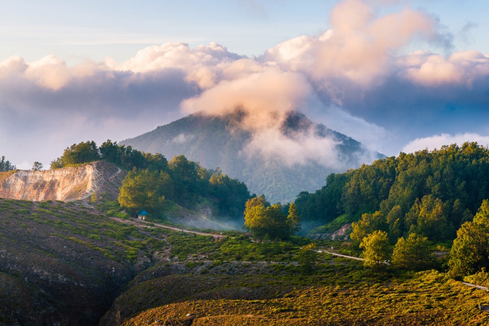
The island's highest point at 999 metres, Manucoco offers panoramic views of the Banda Sea and neighbouring islands. The ascent passes through semi-deciduous tropical forests (approximately 40 km² remain, dominated by Eucalyptus alba) and typically requires a local guide.
Villages and culture
The island is divided into five sucos: Biqueli, Beloi, Macadade, Maquili and Vila Maumeta. The Beloi market, on Saturdays, brings together producers and craftspeople: fresh produce, fish, wood carvings and textiles. The former prison from the Indonesian occupation can be visited as a memorial site.
Bird watching
Atauro welcomes notably the barred dove, the green pigeon of Timor, the olive-headed lorikeet, the orange-flanked thrush and the pink-headed imperial pigeon. The wooded valleys of Manucoco offer the best observation points.
When to go
The dry season (May to November) is most suitable: calm sea, optimal underwater visibility, favourable conditions for boat crossings. The wet season (December to April) brings rain, swell and possible disruptions to crossings. Cetacean migrations (blue whales, sperm whales) are observed mainly from October to December in the Ombai Strait. For hiking Mount Manucoco, favour June-September, cooler and drier.
Practical information
- Duration of visit: allow 2 to 4 days to combine diving, hiking and villages; a week-long stay allows for deeper exploration.
- Accommodation: community eco-lodges, family guesthouses and a few dive resorts. Booking recommended during the dry season.
- Tara bandu: this customary practice, now local law, protects marine resources. 13 managed marine zones govern fishing and ecotourism — respect the signage on snorkelling sites.
- Water and electricity: recurring freshwater shortage and limited electricity depending on villages. Bring a water filter bottle and headlamp.
- Money: no ATM on the island. Withdraw at Dili (currency: US dollar in East Timor).
- Languages: Tetum, Portuguese, Wetarese dialects; some English spoken in tourist accommodation.
How to get there
By boat from Dili
Several connections link Dili to Beloi (Atauro's main port):
- The Berlin Nakroma ferry, generally on Saturdays, an economical option with a journey of 2 to 3 hours.
- The Success cargo ferry, generally on Thursdays, transporting vehicles and passengers.
- Fast boats (speedboats) operate daily depending on weather, with a crossing of approximately 1 hour and higher fares.
- Local fishermen occasionally offer crossings for tight budgets.
Schedules vary by season: check with your accommodation or Dili port the day before departure.
By plane
Mission Aviation Fellowship (MAF) operates flights from Dili, approximately three times per week, for a duration of 15 to 20 minutes. Capacity is limited and booking is made in advance. No commercial international flights serve Atauro directly.
Nearby
Atauro lends itself well to a combined itinerary in East Timor and beyond:
- Dili: capital and gateway, 25 km to the south, Santa Cruz memorial and Cristo Rei statue.
- Alor Island (Indonésie): to the west, another diving hotspot of the strait.
- Wetar Island (Indonésie): to the north-east, little visited, accessible from Atauro for experienced travellers.
To extend your trip on the Indonesian side, consult our pages on Galunggung volcano, Balangan beach in Bali or Bedugul market.
Frequently asked questions
Frequently asked questions
No. Atauro belongs to East Timor and has constituted an autonomous municipality since 1 January 2022. It is surrounded by Indonesian islands (Alor to the west, Wetar to the north-east), which sometimes creates confusion.
A stay of 2 to 4 days allows you to combine snorkelling, hiking and the Beloi market. For diving with certification or prolonged cetacean observation, allow rather 5 to 7 days.
From May to November, the sea is calm and underwater visibility good. October to December concentrates migratory passages of cetaceans in the Ombai Strait.
Entry is via East Timor through Dili. An on-arrival visa is issued at Dili's international airport for most nationalities. Check current conditions before departure.
No. Withdraw your US dollars (official currency in East Timor) at Dili before crossing. Most accommodation does not accept bank cards.
Organise your trip
Atauro fits into a broader regional itinerary combining East Timor and the Indonesian archipelago. To prepare a stay combining diving, volcanoes and island cultures, consult our trips in Indonésie and contact our advisors to integrate an extension to Dili and Atauro.
Interested in this visit?
We can include it in your personalised itinerary.