Papandayan Volcano
Papandayan Volcano
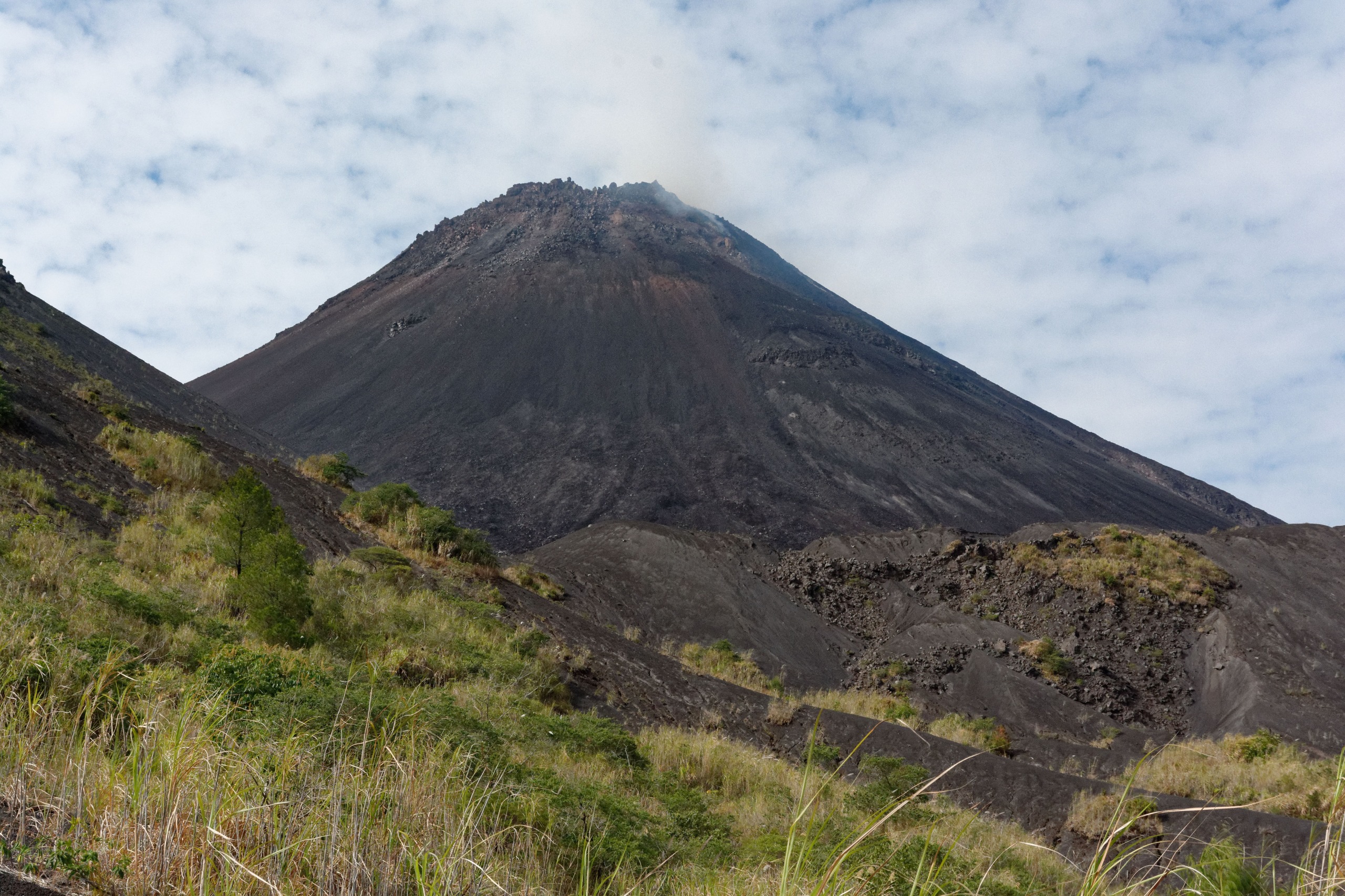
An active stratovolcano in western Java, Papandayan can be summited in a few hours from Garut, amid steaming craters, solfataras and dead forest.
Southeast of Bandung, in western Java, Papandayan volcano rises to approximately 2,665 metres and remains one of the island's most accessible active stratovolcanoes. Four active craters, smoking solfatara fields, acidic hot springs and a manageable hiking trail make it an approachable technical destination for anyone wanting to understand the volcanic mechanics of Indonesia.
Why visit Papandayan
Papandayan stands apart from its Javanese neighbours through its relative accessibility: you reach the crater rim after a moderate hike, without mandatory overnight camping, making it ideal for a day trip from Bandung or Garut.
On-site, several geothermal phenomena coexist within a confined area:
- Sulphur basins and solfataras in permanent activity
- Fumaroles escaping from cracks in the Alun-Alun crater
- Hot springs feeding an acidic stream
- Sporadic mud volcanoes
- Dead forest (Hutan Mati) frozen by past lava flows
The whole landscape offers a rare observation site to understand, without specialist equipment, how an actively monitored volcano functions.
A dramatic eruptive history
Papandayan entered history through its devastating 1772 eruption, which triggered the collapse of its northeast flank. The pyroclastic avalanche that followed claimed nearly 3,000 lives and ravaged around forty surrounding villages. The massif owes its current configuration to this catastrophe, divided into two peaks: Papandayan proper and Mount Puntang.
The following decades saw only minor phreatic eruptions, until significant explosive activity resumed in November 2002. Alert levels rose again in 2011:
- On 13 August 2011, the alert level escalated from Vigilant to Alert, with a 2 km safety perimeter imposed around active craters.
- On 2 September 2011, Indonesia's Centre for Volcanology reported a series of volcanic earthquakes suggesting an imminent eruption.
- The National Disaster Management Agency estimated that over 170,000 residents could be affected and initiated precautionary evacuation of up to 11,500 people.
No major eruption ultimately occurred, but the episode serves as a reminder that the volcano remains under close surveillance.
What you'll see on the trail
Papandayan features four active craters emitting fumaroles. The largest, the Alun-Alun crater, reaches 1.1 km in width and structures the entire summit landscape. The main crater descends approximately 240 metres below the rim, allowing you to observe it from above via the marked trail.
Key points on the hike
- Cisurupan parking: classic starting point, around 2,100 m altitude.
- The solfatara field: zone to traverse with caution; the sulphur odour is strong and the ground sometimes unstable.
- Alun-Alun crater: main observation point over fumaroles and sulphur basins.
- Hutan Mati (dead forest): bleached trunks frozen by an ancient eruption.
- Tegal Alun: high-altitude meadow covered with Javanese edelweiss in season.
Along the route, you'll also observe small sporadic mud volcanoes, ranging from tens of centimetres to just over a metre in height, as well as a stream that becomes progressively charged with acidic elements as it descends.
When to go
The best period to climb Papandayan falls during the dry season, from May to November. Trails are more stable, fumaroles clearly visible and views of neighbouring volcanoes are unobstructed. The site remains accessible year-round, but during the rainy season (December to April), terrain becomes slippery and visibility at the crater drastically reduces. Prioritise an early departure: afternoon clouds quickly obscure the peaks.
How to get there
Papandayan sits approximately 70 km southeast of Bandung, in Garut regency. Two main options:
- From Bandung: allow 3 to 4 hours of road time to Cisurupan parking, by private car or long-distance taxi.
- From Garut: the most practical option. The town concentrates accommodation and local minibuses (angkot) reach the volcano's base for a modest fare. Ask drivers on-site; the route is well marked.
- From Jakarta: possible by car, but allow 6 to 8 hours accounting for typical traffic.
Spending one night in Garut the day before your climb is the most comfortable option.
Practical information
- Difficulty: moderate. No mountaineering skills required, but good fitness is recommended.
- Duration: 3 to 5 hours round-trip for the classic loop passing the crater and dead forest.
- Equipment: closed hiking shoes essential (acidic, abrasive soil), mask or scarf for fumarole zones, water, windbreaker, sun protection.
- Guide: not mandatory on the main trail, but recommended for venturing off-path or understanding local geology.
- Entry: park access fee collected at the entrance, modest rate.
- Safety: respect marked distances around craters and check the alert level before departure.
To combine in the region
Papandayan easily integrates into a western Java volcanic circuit:
- Kawah Putih, in Bandung district: another emblematic crater with milky turquoise waters, accessible by car.
- Cangkuang temple, near the lake of the same name: Hindu-Buddhist edifice from the 8th century, near Garut.
- Cipanas hot springs, at Garut, to recover after your hike.
To extend your volcanic experience in Indonesia, Komodo Island and Rinca Island offer complete immersion, as does the Sipiso-Piso waterfall in Sumatra.
Frequently asked questions
Frequently asked questions
Preparing your trip
Papandayan fits into a western Java itinerary that can combine active volcanoes, tea plantations and cultural heritage. To build a bespoke circuit incorporating this climb, consult our Indonesia travel ideas.
Interested in this visit?
We can include it in your personalised itinerary.