Hiking in Bali: heading toward the island's most beautiful volcanoes!
Situated in the ring of fire, the Island of the Gods is a volcanic territory dotted with superb craters and calderas. From Agung to Lake Bratan: discover the most beautiful hikes on the slopes of Bali's volcanoes and its surroundings.
Situated in the ring of fire, the Island of the Gods is a volcanic territory dotted with superb craters and calderas. From Agung to Lake Bratan: discover the most beautiful hikes on the slopes of Bali's volcanoes – and its surroundings.
Agung (Bali's highest volcano)
The volcano
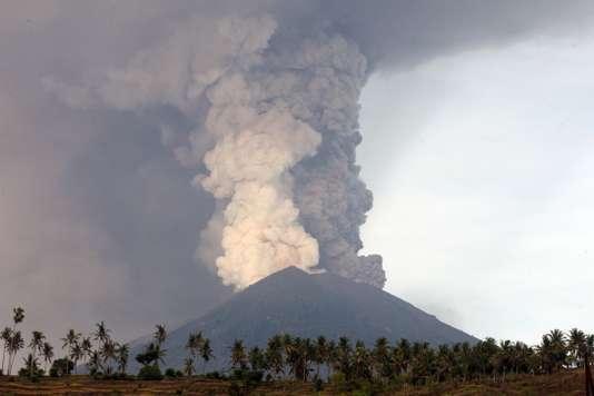
Standing at 3,142 meters above sea level, Mount Agung volcano (or gunung Agung) is the highest point of Bali. It is recognizable by its perfectly conical and steep shape, typical of stratovolcanoes. The two most recent major eruptions of Mount Agung occurred in 1963 and 2017.
The gunung Agung is also a fertile and sacred mountain, which has been the object of worship for millennia. It is customary for locals to leave offerings there and pray in hopes of obtaining abundant harvests.
On the slopes of the volcano, at 1,000 meters, stands the Pura Besakih temple – a vast sacred site of 23 temples, designed in 1340!
The ascent
Despite the activity of its volcano, Mount Agung is open to hiking – but intended for experienced trekkers. There are two trails to make the ascent:
From Pura Besakih: from the temple, plan for 6 or 7 hours of hiking to reach the volcano. The route begins in the jungle, and as you climb, the tropical forest gives way to lunar landscapes… Once you reach the summit? You'll enjoy a superb panoramic view, comprised of terraced rice fields, hills, and Mount Rinjani. Plan for approximately 3 hours for the descent.
From Pura Pasar Agung: from this Hindu temple (located at 1,700 meters), the ascent is shorter – but steeper – with 4 hours of hiking. This trail does not lead all the way to the summit, unlike the first route, but allows you to climb to 2,900 meters altitude.
|
Practical information ● Last eruption: 2017 ● Activity: active ● Ascent: difficult ● To know: climbing gunung Agung is recommended from March to November, during the dry season (rain can make the trail slippery and dangerous). It is possible to do the trek with a local guide (price around €50 per person). |
Mount Batukaru (and its lush volcano)
The volcano
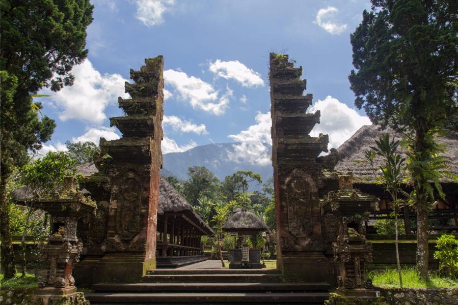
Located at 2,276 meters above sea level, Mount Batukaru (or Batukau) is the second highest peak of Bali. Inactive for millennia, its volcano is covered in lush vegetation and primary forests – considered natural reserves of biodiversity!
The ascent
The trek goes through the forest and takes 5 or 6 hours of hiking, starting from the Batukaru temple, located at 900 meters above sea level. During the ascent, you will encounter many birds, as well as altars and offerings left by the faithful on pilgrimage.
Once at the summit (weather permitting), you'll have a chance to admire the Buyan and Tamblingan lakes. Note that it's also possible to start the route from the Bhujangga temple.
|
Practical information ● Activity: inactive ● Ascent: difficult, with many steep sections ● To know: the hike departs very early in the morning (around 4 a.m.). To do this trek, it is recommended to go with a guide. |
Mount Batur (and its caldera)
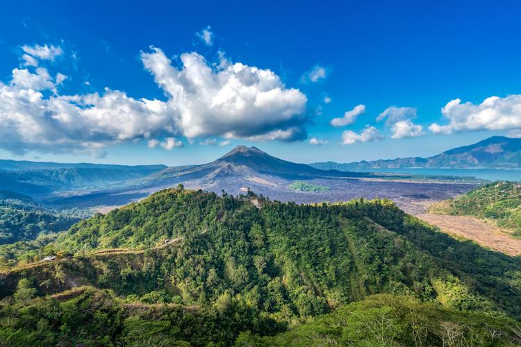
The volcano
Standing at 1,711 meters above sea level, Mount Batur is the most visited volcanic site in Bali. Originally? The volcano reached over 3,000 meters, before an eruption destroyed its upper part; creating then a vast circular depression (a caldera).
Batur is an active volcano. While its last eruption dates to 2000, the most spectacular occurred in 1917. At that time, the volcanic explosion destroyed many homes – but spared the Pura Ulun Danu temple (an important Shivaite Hindu structure).
The ascent
Ascending Mount Batur takes approximately 2 hours. Though this trek passes through some steep areas, it does not require being an experienced hiker. Once you reach the summit? You'll enjoy an exceptional view of Lake Batur and, if the weather is clear, of Mount Rinjani (located on the island of Lombok).
|
Practical information ● Last eruption: 2000 ● Activity: active ● Ascent: easy ●Period: Mount Batur is accessible year-round, but preferably avoid the rainy season (November to March). ● To know: the presence of a guide is not mandatory. However, be aware that an unofficial network prevents tourists from climbing Mount Batur… To avoid finding yourself in this situation, it is preferable to arrange the ascent with a (real) guide. |
Mount Abang (the least touristy)
The volcano
Mount Abang is a stratovolcano located in northern Bali, across from Mount Batur. Standing at 2,152 meters above sea level, it is one of the least visited peaks on the island – with an ascent that requires nearly 6 hours of hiking through the jungle.
The ascent
Climbing Mount Abang is quite lengthy. As a result, it is possible to do a 3-hour trek and stop halfway. This option allows you to admire the beauty of lush landscapes.
For the most determined, the summit offers a superb panoramic view… A tip? Schedule the hike early in the morning to witness the sunrise and take great photos!
|
Practical information ● Activity: inactive ● Ascent: relatively easy on the first half of the route, more demanding on the final stretch. |
The Bratan Caldera (and its lake)
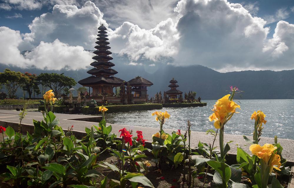
The site
As its name suggests, the Bratan Caldera is not exactly a volcano, but a circular basin formed after the collapse of the volcanic summit. Nevertheless, as it is one of the most beautiful natural sites in Bali, it is impossible not to mention it!
The ascent
The caldera of the ancient Bratan volcano contains three lakes: Buyan, Tamblingan, and Bratan. The latter (also named Danau Bratan) is home to the famous Pura Ulun Danu Bratan temple – spared by the eruption of Mount Batur in 1917.
Its particularity? The building was constructed on the waters of the lake! Many locals come to leave offerings there, intended for the goddess Dewi Danu. To access the temple, you will need to hike to 1,200 meters altitude, in the mountainous heights of the village of Bedugul.
Kawah Ijen (the Java volcano accessible from Bali)
The volcano and its acidic lake
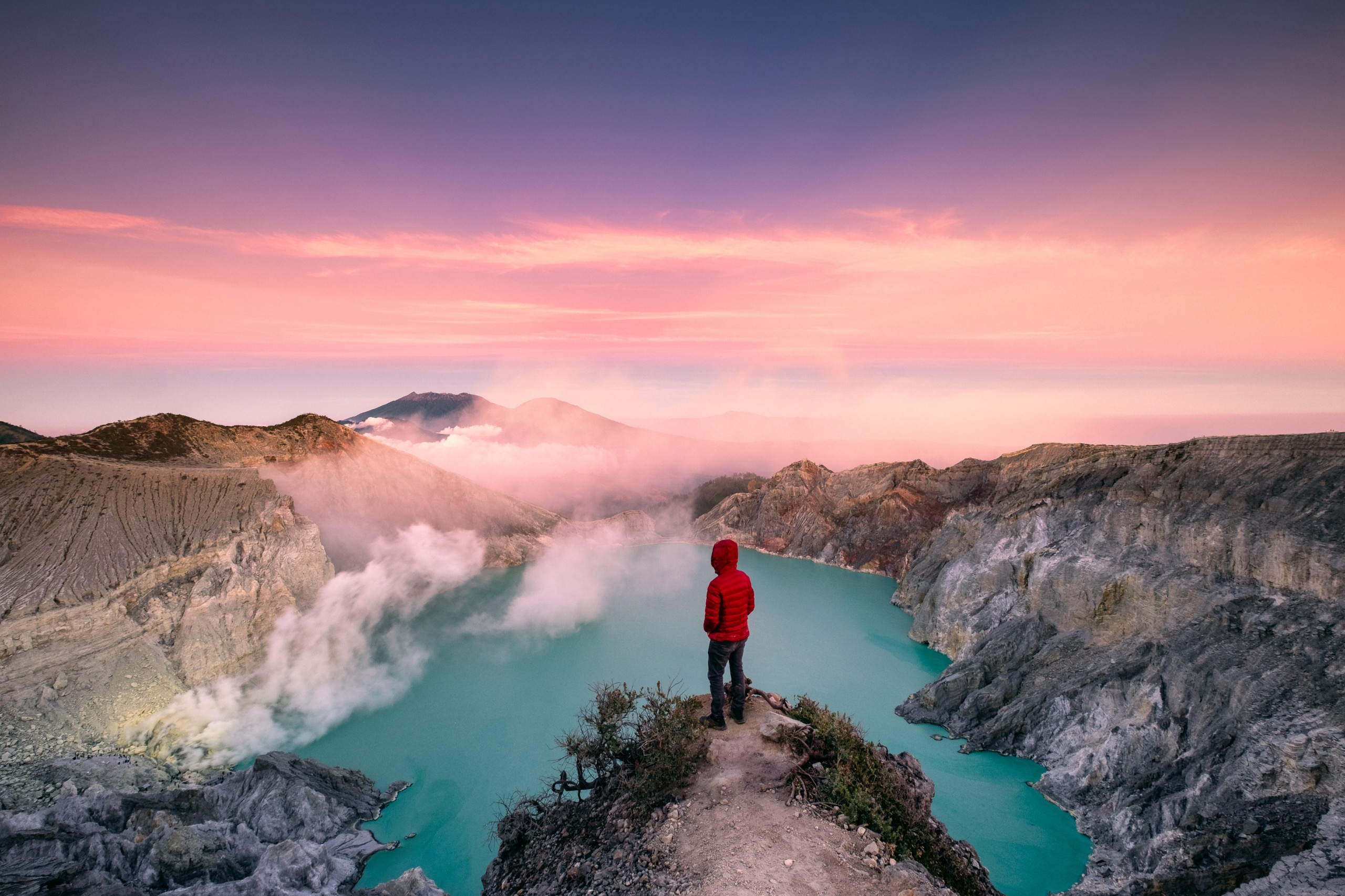
Located east of the island of Java, the Kawah Ijen volcano rises not far from the island of Bali. For passionate trekkers, this natural treasure is an emblematic volcanic site – easily accessible by ferry, then by bus, from Balinese shores.
What makes it a must-see? Its sublime acidic lake! Perched at 2,200 meters altitude, at the heart of a crater, this unique lake is known for its emerald hue (which inspired the volcano's name – "green crater"). This distinctive color is due to a high concentration of sulfur and sulfuric acid, from gases emitted by the volcano.
The volcanic activity of Kawah Ijen generates a large quantity of sulfur – which represents an important natural resource for the region. Indeed, this natural element is used in many industrial sectors, and therefore holds great economic importance. During your ascent, you will encounter sulfur carriers, laden with dozens of kilos.
The ascent
Climbing Kawah Ijen volcano can be done during the day or at night, depending on what you want to see.
By day: you can admire the beauty of the emerald-colored lake, as well as the 360° panoramic view offered by the summit of Mount Ijen. Departure is around 4 a.m., to be among the first hikers to admire the sunrise, while the nocturnal trekkers begin their descent.
By night: the excursion is quite different, with the possibility of seeing the blue fire (the famous blue flames generated by the volcano's activity – invisible during the day) and witnessing the sunrise. The nocturnal departure is around 2 a.m., to ensure you arrive before the first rays of sunlight – which would prevent you from seeing the flames!
|
Practical information ● Geographic location: the island of Java ● Altitude: 2,769 m ● Activity: active ● Last eruption: 2002 ● Ascent: moderate level that requires only good physical fitness. The trail itself is quite easy, with difficulties more related to climbing conditions (hot winds, water vapor, dust, etc.). ● To know: the hike does not require the presence of a guide, but requires wearing a gas mask near the lake. |
Frequently asked questions
Where are the active volcanoes in Bali?
Bali has two active volcanoes: Mount Agung (whose last eruption dates back to 2017) and Mount Batur which erupted in 2000 (and whose next eruption is estimated for 2062).
When did the last eruption occur in Bali?
The most recent major volcanic eruption in Bali was that of Mount Agung which occurred in 2017. At that time, this natural phenomenon had forced several thousand people to evacuate the region. Ash, carried by the wind, had filled the sky, forcing airlines to cancel hundreds of flights.
Audrey Denjean